Solar Eclipse Astrophotography & Astrophysics
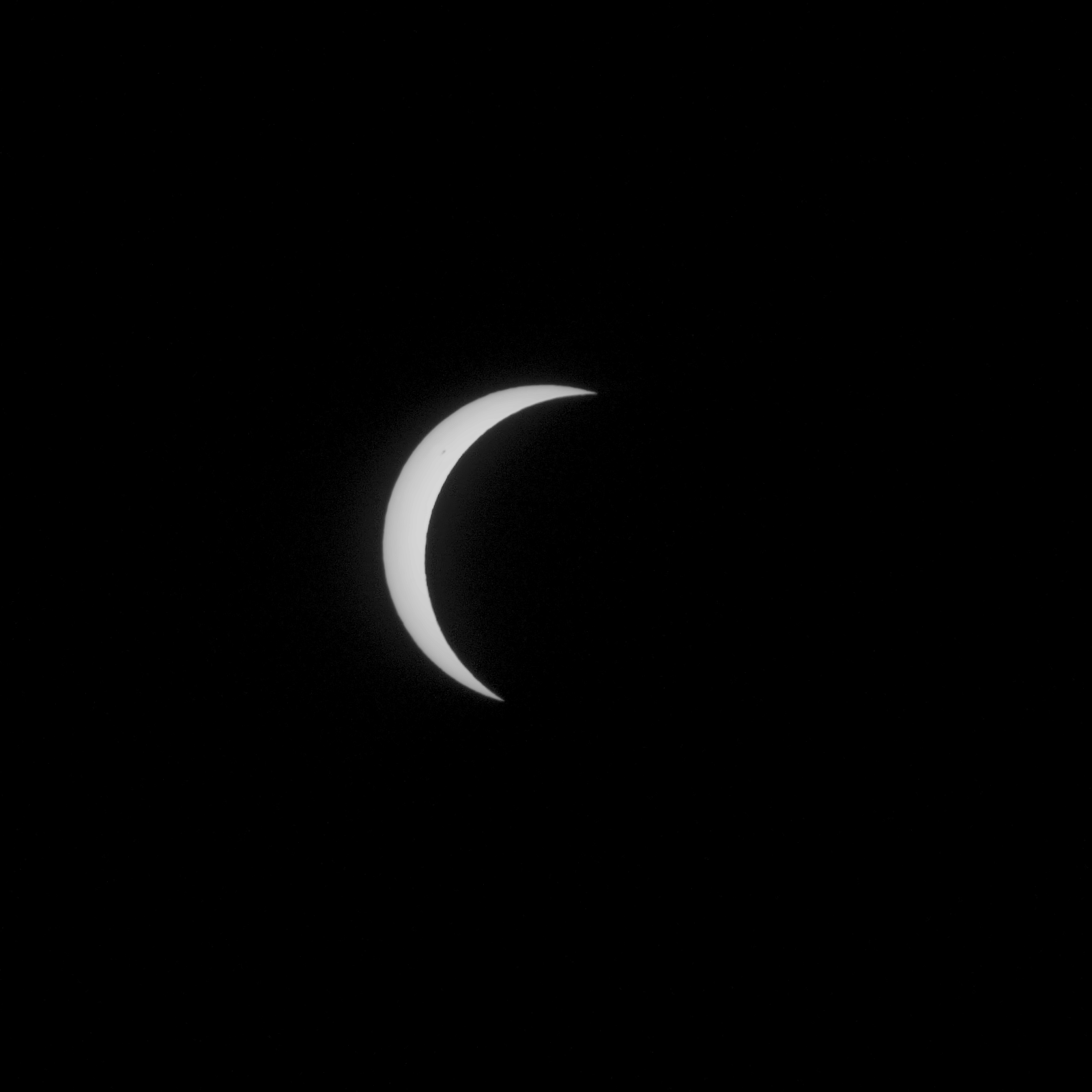
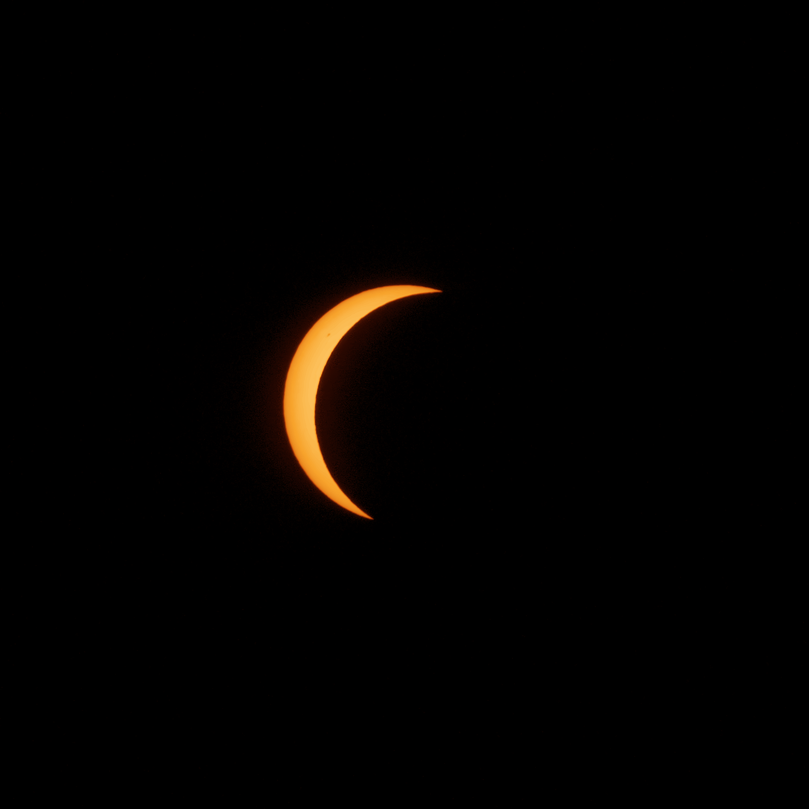
On the evening of August 12, 2026, the sun dropped toward the western horizon in a deep 99.34% partial eclipse. By shooting linear 14-bit RAWs through a homemade solar filter with zero sensor clipping, this photographic sequence became a calibrated instrument to measure solar limb darkening and atmospheric extinction.
Location-Dependent Sky & Horizon Ephemeris
Solar altitude, crescent tilt, and obscuration change dramatically depending on your exact geographic position. Explore how the eclipse appeared across Spain and Europe, or enter your own coordinates.
Why does the crescent tilt? As the sun sets, the celestial equator cuts into the local horizon at an angle equal to (90° - Latitude). In Gredos (40.35°N), the solar axis is tilted ~48° relative to the horizon, rotating the lunar bite from a high-afternoon 'horn' to a horizontal sunset 'smile'.
Interactive Frame Inspection Studio
Step through the 58 centrable eclipse frames and 7 sunset coda frames. Every frame is registered with sub-pixel circle fitting and tone-mapped in linear light.
2D Lunar Transit Vector Recovery
A 1D light curve cannot reveal which direction the moon crossed the sun. However, on any registered solar disc, the area-weighted first moment (centroid) of the lit crescent points strictly opposite the moon.
The Line of Centres Theorem
Because the lit crescent is the solar disc minus the circular overlap, its area centroid lies exactly on the line connecting the Sun and Moon centres:
By tracking this centroid across 58 frames, we reconstruct the moon's 2D trajectory vector with R² > 0.999 linearity, independently confirming the 0.051 R_sun closest approach distance.
Solar Astrophysics from Camera RAWs
Because the sensor never saturated (brightest photosphere sat 2.8 stops below clipping), the raw pixel counts are strictly proportional to photon flux, allowing real solar physics measurements.
Photospheric Temperature Gradient & Limb Darkening
When looking at the centre of the sun, our line of sight reaches deeper into hotter layers (6400 K). Toward the limb, we only see higher, cooler layers (4500 K). Because Planck's law causes hot gas to emit much more blue light, the solar limb darkens much faster in blue wavelengths than in red.
Computational Astrophotography & RAW Pipeline
How consumer photographic hardware was transformed into a high-precision scientific instrument through sub-pixel geometry, sidereal drift modeling, and linear photometric calibration.
14-Bit Linear Sensor Extraction
Direct conversion of Sony ILCE-6400 RGGB Bayer CFA data (B0 = 512, saturation at 16383). No camera tone curves, sharpening, or sRGB gamma applied, preserving strict photon flux linearity.
Sub-Pixel Geometric Inversion
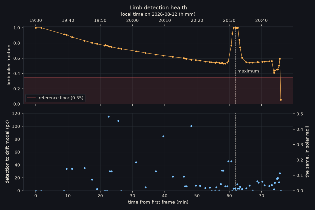
Algebraic Kåsa-Taubin circle fitting on the uneclipsed solar limb. Determines the exact optical center (x0, y0) and solar radius (R = 238.43 px) with residual RMS < 0.04 px.
Sidereal Drift Decomposition
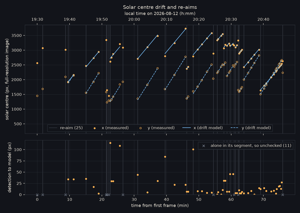
28 manual tripod re-aims were decomposed into a continuous piecewise-linear celestial drift model at 3.635 px/s, recovering absolute temporal alignment (R² > 0.9998).
Boundary Offset Paradox (δ)
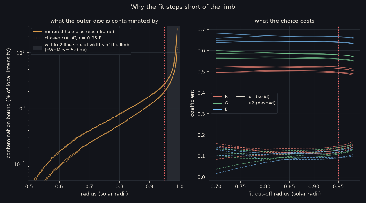
A sub-pixel threshold offset of δ = 0.818 px was calibrated on uneclipsed frames, correcting a +0.42% perimeter-to-area systematic bias on thin crescent measurements.
Planckian Tone Grading & LUTs
Möbius tone-shoulder compression and 3 calibrated grading LUTs: Warm Gold (solar atmosphere), True Solar Neutral (5778 K blackbody), and Monochrome (pure photon density).
Dynamic Sequence Poster Architect
Create astronomical sequence posters where distance along the axis is strictly proportional to physical time (x ∝ t). Renders real linear RAW image crops across all layout modes.
The Camera, Homemade Filter & Sidereal Math
How consumer photographic gear was turned into a high-precision astronomical sensor.
Mathematical Foundations & Ephemeris Derivations
Formulations derived from first principles for clock synchronization, celestial mechanics, and radiative transfer.
Besselian Polynomial Reduction
Local contact times $T$ are computed from the Besselian fundamental plane $(x, y, d, \mu, l_1, l_2)$:
Piecewise-Linear Sidereal Drift Decomposition
Within each continuous tracking block $k$, the solar center in sensor pixels $(x_s, y_s)$ evolves as:
Möbius Tone Shoulder Compression
Linear sensor DNs are mapped to display luminances without clipping highlights:
IGN / OAN Spain Calibration & Ephemerides
Topocentric solar/lunar coordinates, contact times, and duration tables across Spain are calibrated against official Besselian elements published by the Instituto Geográfico Nacional (eclipses.ign.es).